The year’s highest tides arrive next week, and forecasters say a Tuesday storm could push bay water even higher
Showers end this afternoon. Light rain returns this weekend, Monday is the dry day, and a stronger storm with up to 3 inches of rain is due Tuesday into Wednesday.

The highest tides of the year, known as king tides, arrive Nov. 24 to 26, and the National Weather Service’s Bay Area office says a storm due the same days could push water even higher along the bay shoreline. The office said early Friday that its coastal flood advisory for San Francisco Bay and San Pablo Bay shorelines will likely be upgraded to a coastal flood warning on Sunday and stay in place through next week.
The current advisory, in effect until 11 a.m. Saturday, warns of up to 1.4 feet of water above ground in low-lying areas near shorelines and tidal waterways, with flooding of low-lying roads and isolated closures. At the San Francisco tide gauge, Saturday’s 8:15 a.m. high tide is forecast at 7.2 feet, 1.4 feet above normal. Forecasters said storm surge from the midweek storm could add to what their tide forecast now shows, and they expect to add Pacific Coast beaches to an advisory as early as Sunday.
Light rain this weekend, then a bigger storm
Showers and a slight chance of thunderstorms end this afternoon. A weaker system brings light rain from Saturday afternoon into Sunday, about a tenth to a quarter of an inch across the region through early Monday, the office said. Even that could cause nuisance flooding, forecasters warned, because soils are close to saturated after this week’s storms. Monday looks dry.
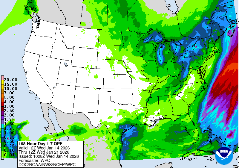
The stronger storm arrives Tuesday into Wednesday, with possible thunderstorms and moderate to heavy rain: 1 to 3 inches in the North Bay and coastal mountains and 1 to 1½ inches across the rest of the Bay Area and Central Coast. Winds are borderline for a wind advisory, the office said. San Jose’s point forecast calls for rain starting after 10 a.m. Tuesday, showers and thunderstorms possible Tuesday night, rain likely Wednesday and a mostly sunny Thanksgiving with a high near 65.
Cold mornings first
A cold weather advisory runs from 1 a.m. to 8 a.m. Saturday for the Eastern Santa Clara Hills, North Bay interior valleys and mountains, the East Bay hills and interior valleys, and parts of Monterey and San Benito counties, with lows of 33 to 36 degrees. San Jose’s forecast low Friday night is around 38.
What this means
If you live, work or commute near the bay shoreline, expect high-tide flooding of low roads and trails next week, and never drive around barricades or through water of unknown depth. Use dry Monday to clear gutters and storm drains and finish outdoor repairs. Anyone traveling the day before Thanksgiving should watch the Tuesday–Wednesday forecast: the weather service says the “storm door” may stay open into late November. On cold mornings, check on neighbors and pets and never run a generator or grill indoors.
Source: National Weather Service Bay Area forecast discussion, coastal flood advisory, cold weather advisory, San Jose forecast and Weather Prediction Center 7-day rainfall forecast.
- National Weather Service San Francisco Bay Area, Area Forecast Discussion, issued Nov. 20, 2026, 4:28 a.m. PST (short and long term issued Nov. 19, 11:47 p.m. PST; beaches section Nov. 19, 1:51 p.m. PST)
- National Weather Service San Francisco Bay Area, Coastal Flood Advisory for San Francisco Bay and San Pablo Bay shorelines, issued Nov. 20, 2026, 3:41 a.m. PST
- National Weather Service San Francisco Bay Area, Cold Weather Advisory (East Bay Interior Valleys and East Bay Hills), issued Nov. 19, 2026, 10:01 p.m. PST
- National Weather Service San Francisco Bay Area, Cold Weather Advisory (Eastern Santa Clara Hills, North Bay and Monterey/San Benito interior), issued Nov. 19, 2026, 10:01 p.m. PST
- National Weather Service San Francisco Bay Area, gridpoint forecast for San Jose (MTR 99,82), updated Nov. 20, 2026, 1:26 a.m. PST
- NOAA/NWS Weather Prediction Center, 7-day precipitation forecast, valid 4 a.m. PST Nov. 20 to 4 a.m. PST Nov. 27, issued Nov. 20, 2026, 2:28 a.m. PST