Two more storms are headed for San Jose this week, and forecasters say the midweek one could raise flood worries
About half an inch is forecast for San Jose Sunday into Monday, with up to an inch in much of the Bay Area. Roughly another inch could fall Tuesday night through Thursday.

Rain returns to San Jose after 2 p.m. Sunday and continues Sunday night, the National Weather Service forecast shows. The weather service’s Bay Area office expects half an inch to an inch across most of the Bay Area and Santa Cruz County by Monday, 1 to 1.5 inches in the Sonoma County coastal hills, and a quarter to half an inch in the inland East Bay. Its San Jose forecast calls for about half an inch. Gusts could reach 20 to 30 mph as the front moves through.
A third storm arrives Tuesday night and lasts into Thursday. Forecasters say it is too early to be confident about totals, but it looks stronger and slower than Sunday’s. They warn that flooding concerns will grow as soils soak up water and creeks fill to their banks.
How much rain where
The weather service’s latest point forecasts, which will likely change, show these totals for Sunday through Monday and then Tuesday through Thursday: San Jose and Gilroy, about half an inch, then about 1.1 inches. Palo Alto, about 0.6 inch, then about 1.2 inches. Oakland and San Francisco, about half an inch, then about 1.3 inches. Santa Rosa, about 0.6 inch, then about 1.3 inches. The Santa Cruz Mountains near Boulder Creek, about 0.9 inch, then about 1.6 inches.
Added together, that is about 1.5 inches for San Jose over both storms and close to 2.5 inches in the Santa Cruz Mountains.
On the coast, a high surf warning runs until 4 a.m. Sunday, with breaking waves of 25 to 35 feet. Another round of very large swell is due Monday.
What it means
Plan for a possibly wet Monday morning commute and a rainy Wednesday. Valley Water offers free sandbags in San Jose at 1661 Senter Road and on Winfield Boulevard between Blossom Hill Road and Coleman Avenue, and in Alviso. To report a creek blocked by debris, call Valley Water at 408-630-2378. Stay off beaches and jetties this weekend.
Source: National Weather Service Bay Area forecast discussion, San Jose forecast, National Weather Service gridpoint forecasts and Valley Water.
- National Weather Service San Francisco Bay Area, Area Forecast Discussion, issued Nov. 14, 2026, 9:37 a.m. PST (long term section issued 12:02 a.m. PST)
- National Weather Service San Francisco Bay Area, gridpoint forecast for San Jose (MTR 99,82), updated Nov. 14, 2026, 8:56 a.m. PST
- National Weather Service point forecast for San Jose (37.3382, -121.8863)
- National Weather Service San Francisco Bay Area, High Surf Warning (CAZ006, 505, 509, 529, 530), issued Nov. 14, 2026, 1:05 a.m. PST, in effect until 4 a.m. PST Nov. 15
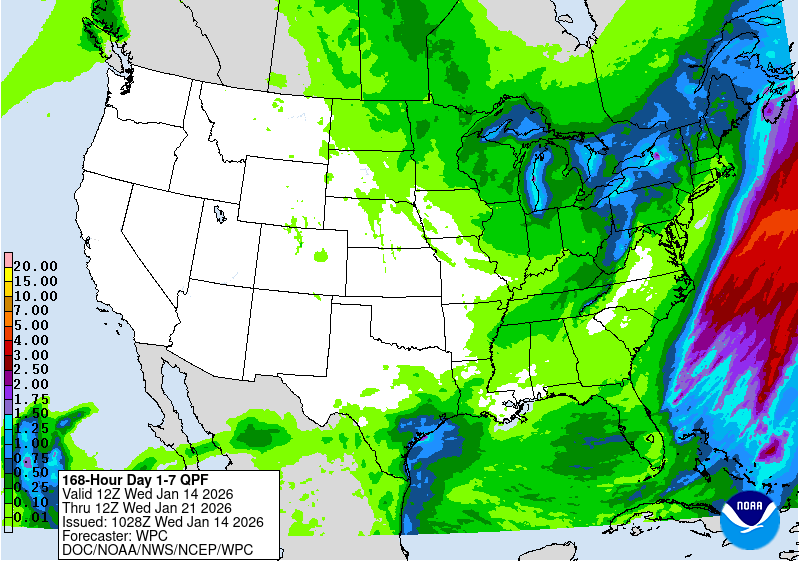
- NOAA/NWS Weather Prediction Center, 7-day quantitative precipitation forecast, issued 10:05 UTC Nov. 14, 2026 (2:05 a.m. PST)
- Santa Clara Valley Water District, Sandbag distribution sites
- Santa Clara Valley Water District, Get Flood Ready (blockage hotline)
- National Weather Service San Francisco Bay Area, gridpoint forecast data for Gilroy (MTR 108,65), quantitative precipitation, updated Nov. 14, 2026, 8:56 a.m. PST
- National Weather Service San Francisco Bay Area, gridpoint forecast data for Palo Alto (MTR 91,89), quantitative precipitation, updated Nov. 14, 2026, 8:56 a.m. PST
- National Weather Service San Francisco Bay Area, gridpoint forecast data for Oakland (MTR 90,105), quantitative precipitation, updated Nov. 14, 2026, 8:56 a.m. PST
- National Weather Service San Francisco Bay Area, gridpoint forecast data for San Francisco (MTR 85,105), quantitative precipitation, updated Nov. 14, 2026, 8:56 a.m. PST
- National Weather Service San Francisco Bay Area, gridpoint forecast data for Santa Rosa (MTR 81,137), quantitative precipitation, updated Nov. 14, 2026, 8:56 a.m. PST
- National Weather Service San Francisco Bay Area, gridpoint forecast data for Santa Cruz Mountains near Boulder Creek (MTR 89,75), quantitative precipitation, updated Nov. 14, 2026, 8:56 a.m. PST